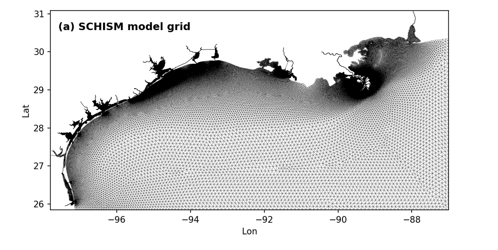
A 3-D unstructured-grid hydrodynamic model for the northern Gulf of Mexico was developed, with a hybrid s–z vertical grid and high-resolution horizontal grid for the main estuarine systems along the Texas–Louisiana coast. This model, based on the Semi-implicit Cross-scale Hydroscience Integrated System Model (SCHISM), is driven by the observed river discharge, reanalysis atmospheric forcing, and open boundary conditions from global HYCOM output. The model has been well calibrated in terms of salinity, temperature, surface elevation, velocity (both at coastal bay and on sehlf), and stratification on the shelf. Combined with observational data, this model has been used to examine the salt exchange, hurricane's impact and pollutant transport.
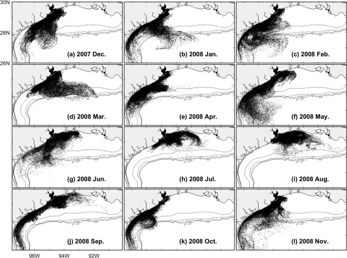
One application of the model is to understand how transport of coastal materials is regulated by larger-scale shelf dynamics. Depending on the release time, materials exiting the coastal bays will be subject to the evident seasonal variations of the shelf current. Over the Texas-Louisiana Shelf, current is typically in downcoast direction (from Mississippi River to southwest of Texas) during non-summer season, while in upcoast direction during summer. It is still unclear how the deep ocean dynamics (e.g., meso-scale eddies shed from Loop Current) will shape the distribution of coastal material in a longer timescale. Current model domain is not big enough to resolve the deep ocean meso-scale processes.
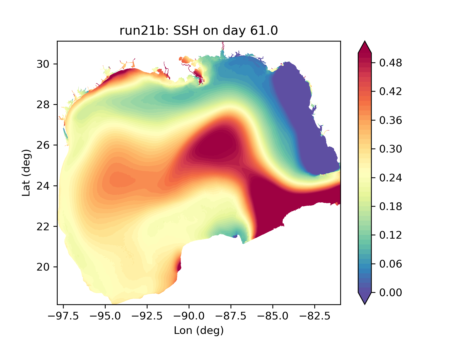
We expand the model domain to resolve the deep ocean in an effort to consider the deep-shelf-esturies as a whole. By using a third-order transport scheme (WENO), we succesfully simulate the loop current eddy activies in the deep basin of Gulf of Mexico (see figure to the left for a snapshot of sea surface height on day 61 in 2018). Because of the eddy activity and continuous feed of warm water by loop current, the center of the Gulf has higher sea surface height, resulting in upcoast current at the shelf break, an important physical setting for the northern Gulf of Mexico. Resolving the eddy expan our domain and allow us to go deeper and further offshore.
© Texas A&M University (Galveston Campus), 2023. All rights reserved.